
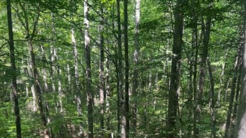
Ledford Gap/Powhatan Loop: 7 mi., 1,100 ft. elev.
A patchwork loop through Bent Creek strings together Bent Creek Gap Rd and trails like Explorer Loop, Sleepy Gap, Shut in, and Homestead for roughly 6.5–7 miles and about 1,100 feet of climbing. Meet at Ledford Branch Trailhead for a midday group hike with plenty of trail junctions and varied terrain.
Similar Events
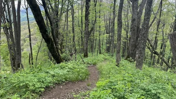
A 7.5-mile Appalachian Trail out-and-back from Sam’s Gap to Rice Gap with steady climbs to roughly 4,500 feet and about 1,700 feet of elevation gain. Pass High Rock and break for a quick lunch stop at Hog Back Shelter before hiking back.
A 7.5-mile Appalachian Trail out-and-back from Sam’s Gap to Rice Gap with steady climbs to roughly 4,500 feet and about 1,700 feet of elevation gain. Pass High Rock and break for a quick lunch stop at Hog Back Shelter before hiking back.
A 7.5-mile Appalachian Trail out-and-back from Sam’s Gap to Rice Gap with steady climbs to roughly 4,500 feet and about 1,700 feet of elevation gain. Pass High Rock and break for a quick lunch stop at Hog Back Shelter before hiking back.
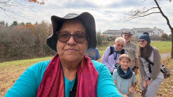
A moderately difficult 3.5-mile counterclockwise loop on Biltmore’s narrow Westover Black Trail, winding through quiet woodlands with steady elevation changes. Suited for walkers who want a brisk, scenic group hike starting near The Inn.
A moderately difficult 3.5-mile counterclockwise loop on Biltmore’s narrow Westover Black Trail, winding through quiet woodlands with steady elevation changes. Suited for walkers who want a brisk, scenic group hike starting near The Inn.
A moderately difficult 3.5-mile counterclockwise loop on Biltmore’s narrow Westover Black Trail, winding through quiet woodlands with steady elevation changes. Suited for walkers who want a brisk, scenic group hike starting near The Inn.
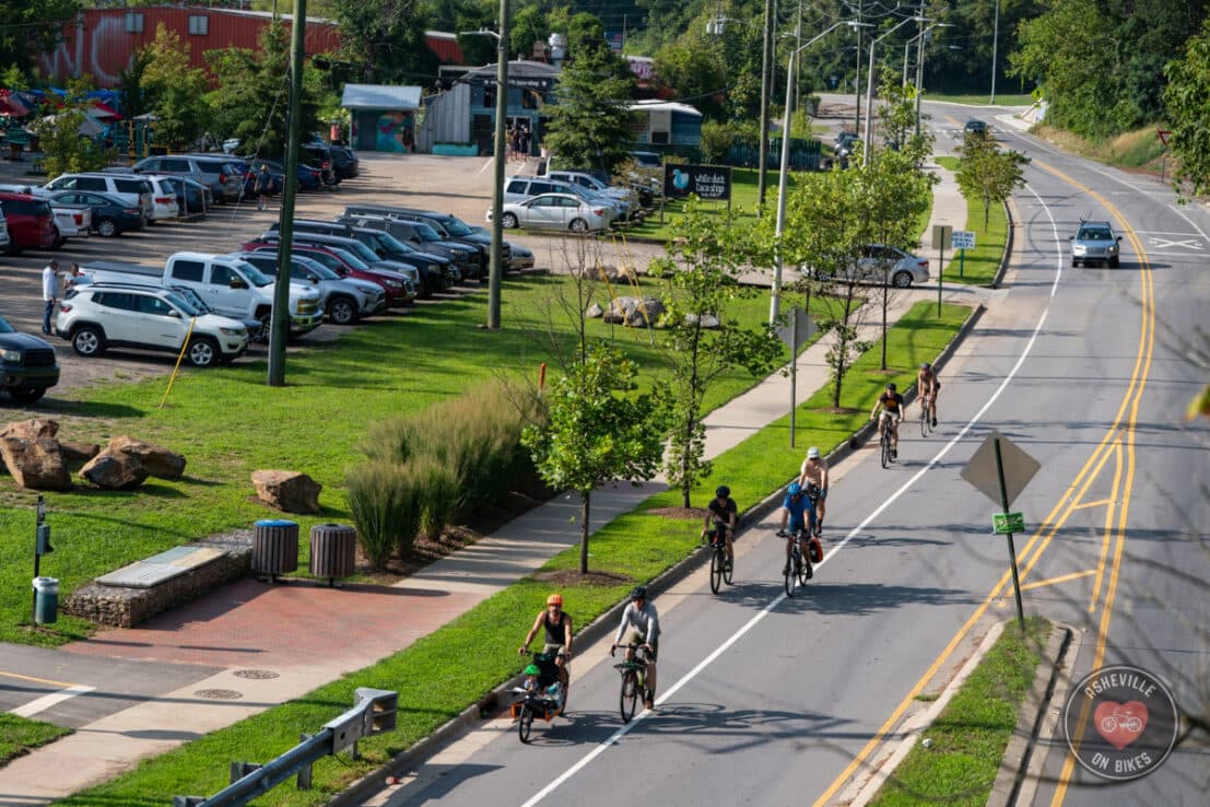
A social paced mountain bike group ride rolls out from the Ledford Trailhead in Bent Creek for a friendly, no drop style trail loop. Expect steady climbing, flowy singletrack, and community focused riding.
A social paced mountain bike group ride rolls out from the Ledford Trailhead in Bent Creek for a friendly, no drop style trail loop. Expect steady climbing, flowy singletrack, and community focused riding.
A social paced mountain bike group ride rolls out from the Ledford Trailhead in Bent Creek for a friendly, no drop style trail loop. Expect steady climbing, flowy singletrack, and community focused riding.
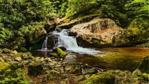
A moderate Sierra Club group hike through Rocky Fork State Park on a streamside forest trail with cascades and small waterfalls. Expect an out and back route around 5 miles with roughly 900 feet of elevation gain; advance signup required via email or Meetup.
A moderate Sierra Club group hike through Rocky Fork State Park on a streamside forest trail with cascades and small waterfalls. Expect an out and back route around 5 miles with roughly 900 feet of elevation gain; advance signup required via email or Meetup.
A moderate Sierra Club group hike through Rocky Fork State Park on a streamside forest trail with cascades and small waterfalls. Expect an out and back route around 5 miles with roughly 900 feet of elevation gain; advance signup required via email or Meetup.
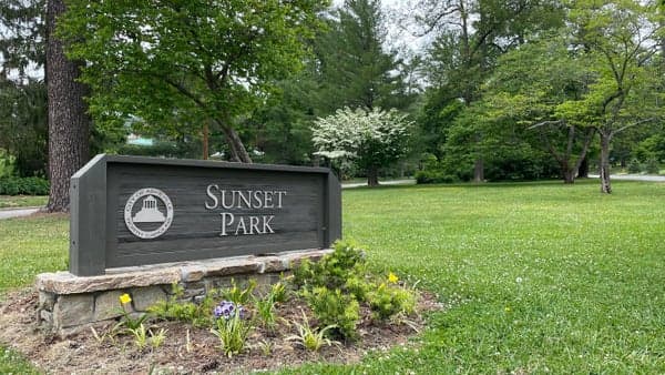
A neighborhood group walk from Sunset Park up Sunset Drive, looping past the Grove Park Inn and back via Macon. Expect a 3.5 mile route with about 433 ft of elevation gain, mostly uphill out and downhill returning.
A neighborhood group walk from Sunset Park up Sunset Drive, looping past the Grove Park Inn and back via Macon. Expect a 3.5 mile route with about 433 ft of elevation gain, mostly uphill out and downhill returning.
A neighborhood group walk from Sunset Park up Sunset Drive, looping past the Grove Park Inn and back via Macon. Expect a 3.5 mile route with about 433 ft of elevation gain, mostly uphill out and downhill returning.

An easy, scenic 3.5-mile Pine Tree Loop walk through Bent Creek starting at the Hard Times Trailhead, paced for conversation and meeting new people. Wrap up with a celebratory Taco Boy lunch after the hike.
An easy, scenic 3.5-mile Pine Tree Loop walk through Bent Creek starting at the Hard Times Trailhead, paced for conversation and meeting new people. Wrap up with a celebratory Taco Boy lunch after the hike.
An easy, scenic 3.5-mile Pine Tree Loop walk through Bent Creek starting at the Hard Times Trailhead, paced for conversation and meeting new people. Wrap up with a celebratory Taco Boy lunch after the hike.
A no drop mountain bike group ride rolls out from Ledford Branch Trailhead in Bent Creek with a supportive pace for the whole pack. After the trails, riders head back to the shop for danishes and post ride hangout.
A no drop mountain bike group ride rolls out from Ledford Branch Trailhead in Bent Creek with a supportive pace for the whole pack. After the trails, riders head back to the shop for danishes and post ride hangout.
A no drop mountain bike group ride rolls out from Ledford Branch Trailhead in Bent Creek with a supportive pace for the whole pack. After the trails, riders head back to the shop for danishes and post ride hangout.

A social group hike to Catawba Falls with a midday meet-up and shared trail time through forested paths to a cascading waterfall. Expect community-focused pacing, casual conversation, and an active outdoor outing near Asheville.
A social group hike to Catawba Falls with a midday meet-up and shared trail time through forested paths to a cascading waterfall. Expect community-focused pacing, casual conversation, and an active outdoor outing near Asheville.
A social group hike to Catawba Falls with a midday meet-up and shared trail time through forested paths to a cascading waterfall. Expect community-focused pacing, casual conversation, and an active outdoor outing near Asheville.

A 3.65 mile neighborhood loop starting at Kenilworth Park climbs Reservoir Road with about 614 feet of elevation gain. Expect a 1.5–2 hour social walk contrasting newer and older Kenilworth streetscapes with steady uphill segments.
A 3.65 mile neighborhood loop starting at Kenilworth Park climbs Reservoir Road with about 614 feet of elevation gain. Expect a 1.5–2 hour social walk contrasting newer and older Kenilworth streetscapes with steady uphill segments.
A 3.65 mile neighborhood loop starting at Kenilworth Park climbs Reservoir Road with about 614 feet of elevation gain. Expect a 1.5–2 hour social walk contrasting newer and older Kenilworth streetscapes with steady uphill segments.
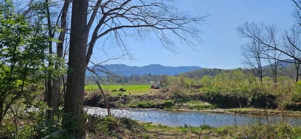
A mostly flat but long 7.5-mile trail hike (400 ft gain) that loops past the Warren Wilson farm and along the river trail, with short rolling ups and downs. Expect a moderate 3.2 mph pace, leashed dogs on preserve sections, and occasional bear sightings.
A mostly flat but long 7.5-mile trail hike (400 ft gain) that loops past the Warren Wilson farm and along the river trail, with short rolling ups and downs. Expect a moderate 3.2 mph pace, leashed dogs on preserve sections, and occasional bear sightings.
A mostly flat but long 7.5-mile trail hike (400 ft gain) that loops past the Warren Wilson farm and along the river trail, with short rolling ups and downs. Expect a moderate 3.2 mph pace, leashed dogs on preserve sections, and occasional bear sightings.

Women-led mountain bike group ride rolling from the Ledford parking lot trailhead in Bent Creek with posted pace and route details. Choose Monday evening or Wednesday morning options tailored to different skill levels and supportive trail camaraderie.
Women-led mountain bike group ride rolling from the Ledford parking lot trailhead in Bent Creek with posted pace and route details. Choose Monday evening or Wednesday morning options tailored to different skill levels and supportive trail camaraderie.
Women-led mountain bike group ride rolling from the Ledford parking lot trailhead in Bent Creek with posted pace and route details. Choose Monday evening or Wednesday morning options tailored to different skill levels and supportive trail camaraderie.
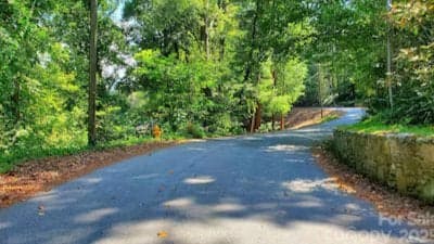
A brisk neighborhood walk from the Merrimon post office into North Asheville with sweeping city views and punchy hill climbs. Expect 2.75 miles, about 600 feet of elevation gain, and periodic regrouping stops over 1–1.5 hours.
A brisk neighborhood walk from the Merrimon post office into North Asheville with sweeping city views and punchy hill climbs. Expect 2.75 miles, about 600 feet of elevation gain, and periodic regrouping stops over 1–1.5 hours.
A brisk neighborhood walk from the Merrimon post office into North Asheville with sweeping city views and punchy hill climbs. Expect 2.75 miles, about 600 feet of elevation gain, and periodic regrouping stops over 1–1.5 hours.
A social paced gravel group ride through Bent Creek around Rice Pinnacle, geared toward casual conversation and steady miles. Expect mixed surface climbing and descents with a friendly, community minded cycling crew.
A social paced gravel group ride through Bent Creek around Rice Pinnacle, geared toward casual conversation and steady miles. Expect mixed surface climbing and descents with a friendly, community minded cycling crew.
A social paced gravel group ride through Bent Creek around Rice Pinnacle, geared toward casual conversation and steady miles. Expect mixed surface climbing and descents with a friendly, community minded cycling crew.
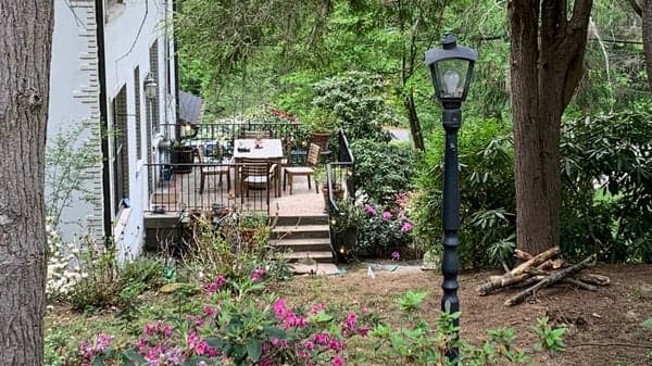
A 3.2-mile neighborhood walk from Sunset Park through the Albemarle Park historic district and up Cherokee Road, with 604 feet of elevation gain. Expect a moderate 2.8 mph pace, steep stretches, and mountain-view streetscapes.
A 3.2-mile neighborhood walk from Sunset Park through the Albemarle Park historic district and up Cherokee Road, with 604 feet of elevation gain. Expect a moderate 2.8 mph pace, steep stretches, and mountain-view streetscapes.
A 3.2-mile neighborhood walk from Sunset Park through the Albemarle Park historic district and up Cherokee Road, with 604 feet of elevation gain. Expect a moderate 2.8 mph pace, steep stretches, and mountain-view streetscapes.
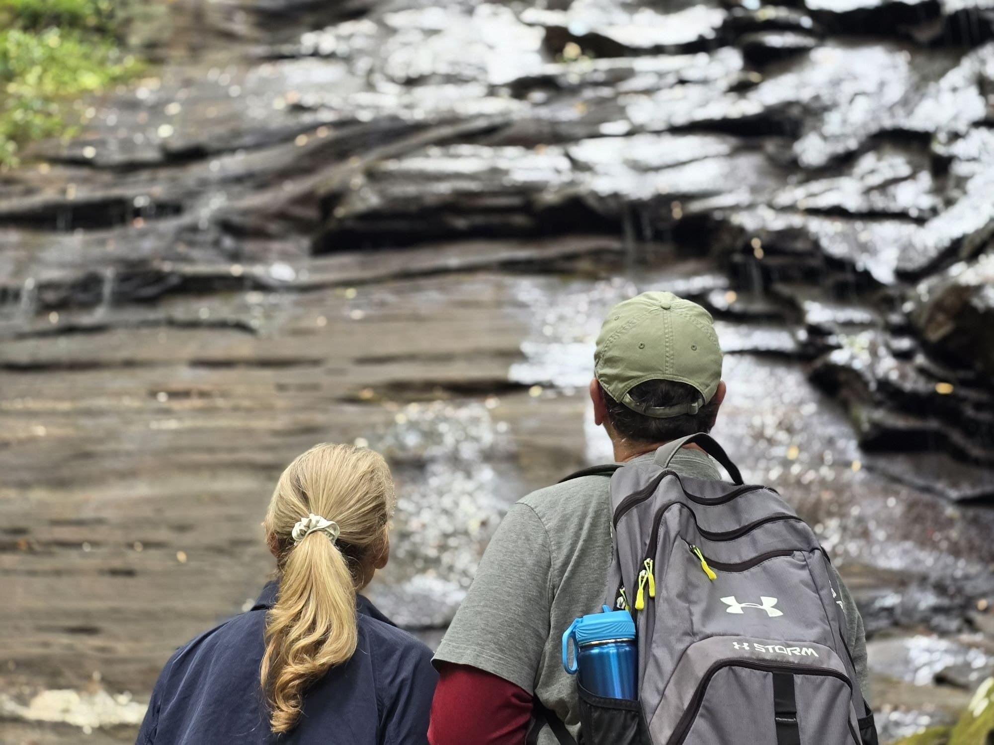
Guided waterfall hike in Pisgah National Forest with a local guide, scenic overlooks, and photo stops along forested trails. Expect a moderate pace, trail safety tips, and a small-group outdoor adventure starting from the outfitter.
Guided waterfall hike in Pisgah National Forest with a local guide, scenic overlooks, and photo stops along forested trails. Expect a moderate pace, trail safety tips, and a small-group outdoor adventure starting from the outfitter.
Guided waterfall hike in Pisgah National Forest with a local guide, scenic overlooks, and photo stops along forested trails. Expect a moderate pace, trail safety tips, and a small-group outdoor adventure starting from the outfitter.
Women-only, no drop mountain bike ride covering a relaxed 6–8 miles with regroup points so nobody gets left behind. Social trail time focused on confidence building and supportive pacing at Ledford Branch Trailhead.
Women-only, no drop mountain bike ride covering a relaxed 6–8 miles with regroup points so nobody gets left behind. Social trail time focused on confidence building and supportive pacing at Ledford Branch Trailhead.
Women-only, no drop mountain bike ride covering a relaxed 6–8 miles with regroup points so nobody gets left behind. Social trail time focused on confidence building and supportive pacing at Ledford Branch Trailhead.